Microsoft Flight Simulator mods
108,516 results- 15 per page
- 30 per page
- 45 per page
- 60 per page
-
See more per page
Bigger pages, fewer clicks - and no ads anywhere.
Go Pro
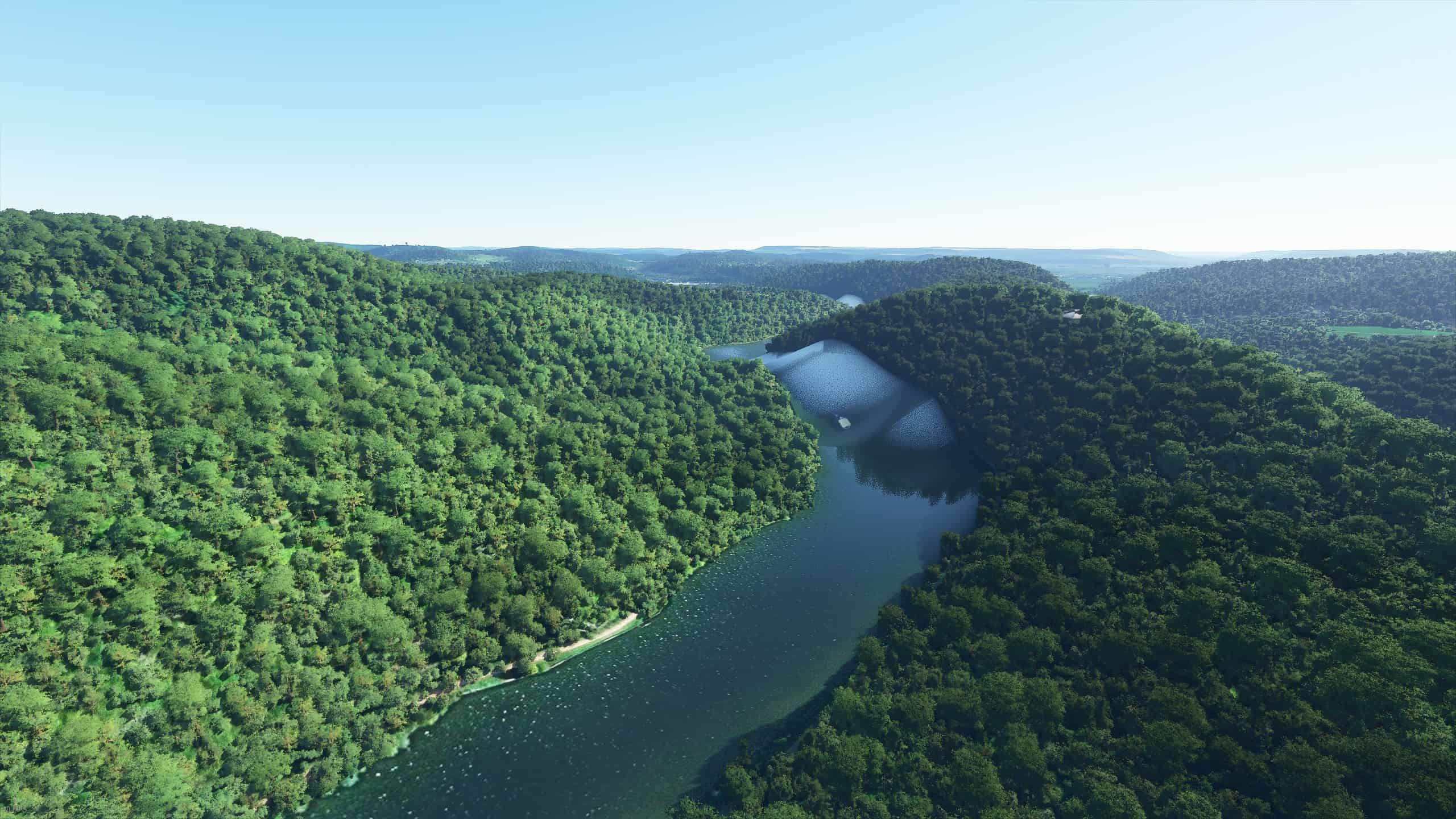
Water elevation fix for the well-known Saar Loop
Water elevation fix for the well-known Saar Loop (Saarschleife) of the river Saar in south west Germany This is a water elevation fix for the tourist sight “Saarschleife” (Saar Loop) of the river called Saar in south west Germany, about 13 km east from where the borders of France, Luxembourg and Germany are coming together. This mod includes elevation fix for 32 km of the river Saar with the “Saarschleife” in between, reaching from the yacht harbor of Merzig to the Saar bridge in Saarburg. I’ve also added a few boats and ships along the way. MSFS 2020 Scenery 13 Oct, 2021 MSFS 2020 Scenery 13 Nov, 2020 MSFS 2020 Scenery 18 Mar, 2021

Orléans City v1.0
Orléans is a prefecture and commune in north-central France, about 120 kilometres (74 miles) southwest of Paris. It is the capital of the Loiret department and of the Centre-Val de Loire region. Orléans is located on the Loire River where the river curves south towards the Massif Central. In 2017, the city had 116,685 inhabitants within its municipal boundaries. Orléans is the center of Orléans Métropole that has a population of 286,257, the 20th largest in France. The largest metropolitan area has a population of 444,681. Île d’Orléans in Quebec, Canada is named after Orleans in France as well as New Orleans, Louisiana. (French: La Nouvelle-Orléans) Orléans is located in the northern bend of the Loire, which crosses from east to west. Orléans belongs to the vallée de la Loire sector between Sully-sur-Loire and Chalonnes-sur-Loire, which was in 2000 inscribed by UNESCO as a World Heritage Site. The capital of Orléanais, 120 kilometres southwest of Paris, is bordered to the north by the Beauce region, more specifically the Orléans Forest (French: forêt d’Orléans) and Orléans-la-Source neighbourhood, and the Sologne region to the south. Five bridges in the city cross the Loire River: Pont de l’Europe, Pont du Maréchal Joffre (also called Pont Neuf), Pont George-V (also called Pont Royal, carrying the commune tramway), Pont René-Thinat and Pont de Vierzon (rail bridge). To the north of the Loire (rive droite) is to be found a small hill (102 m (335 ft) at the pont Georges-V, 110 m (360 ft) at the Place du Martroi) which gently rises to 125 m (410 ft) at la Croix Fleury, at the limits of Fleury-les-Aubrais. Conversely, the south (on the rive gauche) has a gentle depression to about 95 m (312 ft) above sea level (at Saint-Marceau) between the Loire and the Loiret, designated a “zone inondable” (flood-risk zone). At the end of the 1960s, the Orléans-la-Source neighbourhood was created, 12 kilometres (7 mi)to the south of the original commune and separated from it by the Val d’Orléans and the Loiret River (whose source is in the Parc Floral de la Source). This quarter’s altitude varies from about 100 to 110 m (330 to 360 ft). GPS: 47° 54′ 9″ N, 1° 54′ 32.4″ E MSFS 2020 Scenery 15 Jul, 2021 MSFS 2020 Scenery 3 Jan, 2021 MSFS 2020 Scenery 19 Nov, 2020

EPZR Żar Airport Aerial Photos & General Improvements v1.0
This mod adds various improvements and high-resolution zoom level 19 aerial photos for EPZR Żar airport in southern Poland that was really badly represented in the base sim. About the airport: The airport is nested on a mountain called Żar, it has 2 grass runways (04/22, 08/26), with a tower frequency of 122.805. Due to the surrounding mountains you can etiher enter the valley from the north, or south, also you don’t execute a traffic pattern. You can land at the airport only on runway 04 (main) or 08 (secondary) due to the runway slope, you takeoff from the opposite runways. There is no go-around procedure. It’s basically like a Polish version of Courchevel airport. Contents of the mod: Added high-resolution zoom level 19 aerial photos of the area taken from Google Maps; Added trees where they were missing; Changed tree type to deciduous; Changed default hangars to generic hangar buildings that better fit the apron; Added a tower frequency of 122.805; Added apron ground materials; Added static objects (gliders, glider trailers, cars, containers) to the apron and to the vicinity of the airport; Added 3 parking spots and 1 refueling spot; Added a windsock (currently it’s in the wrong place, in real life it’s on top of a hangar, however if it’s placed there in the sim it sometimes goes inside the hangar); Added a radio tower at the top of Żar mountain; Changed the airport type to a star airport. Note: The area in the valley still has really bad photos with tons of clouds. I plan on making additional mods that improve them, but because of the size of those photos, they will be released as a seperate addon in the future. Additional info about the approach 1. Night flights PPR. 2. Aerodrome circuit is not carried out. 3. Landing shall be carried out on RWY 05 (RWY 08 auxiliary). 4. Caution: Due to landing up-hill, executing go-around manoeuvre from landing flare is NOT POSSIBLE. 5. Bidirectional radio communication within ATZ mandatory. 6. Airplanes: a. arriving from the north and west shall proceed to Międzybrodzie Bialskie, then along river valley and next with left turn joining final, b. arriving from the south, shall proceed to Tresna, then along river valley and next with right turn joining final. 7. Gliders approaching to land: a. before proceeding final gliders shall descend in circling zone at south-eastern edge of the airfield (Soła river valley), b. before proceeding final gliders shall descend on heading 230° along north-western edge of airfield and perform 180° left turn on final (along Soła river valley), c. before proceeding final gliders shall descend on heading 230° along north-eastern edge of airfield and perform 180° right turn on final (along Soła river valley). 8. Glider landing manoeuvre is dependant on direction and wind velocity. 9. Glider take-offs: a. winch launching on headings 050° i 230°, b. bungee launching from top of Mt. Żar on headings 000° i 270°. 10. Maintain high vigilance – intensive paragliding activity. 11. Caution: During autumn, winter-spring seasons frequent foehn (“halny”) from the south up to 10-14 m/s. 1) SLOP OF RWY 05/23 6,5% 2) SLOP OF RWY 08/26 5,3%. Known issues: Runway 08/26 is visible on the ground, but isn’t displayed in the airport info. This is because in order to add the runway info you have to add a runway object itself, and that screws up the slope of the runway; Sometimes a car can drive through a portion of the apron. This is because a portion of the apron is detected as road. In the current version of the SDK this can’t be fixed; MSFS 2020 Airports 10 Nov, 2021 MSFS 2020 Airports 5 Nov, 2021 MSFS 2020 Airports 9 Sep, 2021
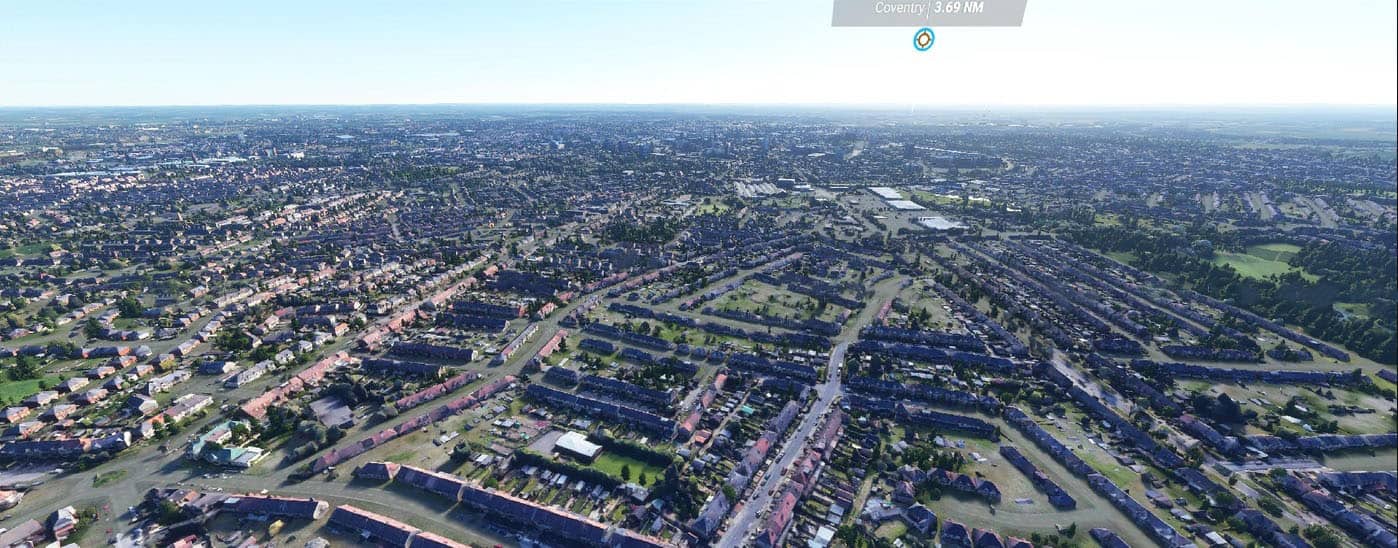
Coventry City UK v1.0
Coventry City UK MSFS 2020 Scenery 6 Jan, 2022 MSFS 2020 Scenery 24 Jun, 2021 MSFS 2020 Scenery 9 Nov, 2020
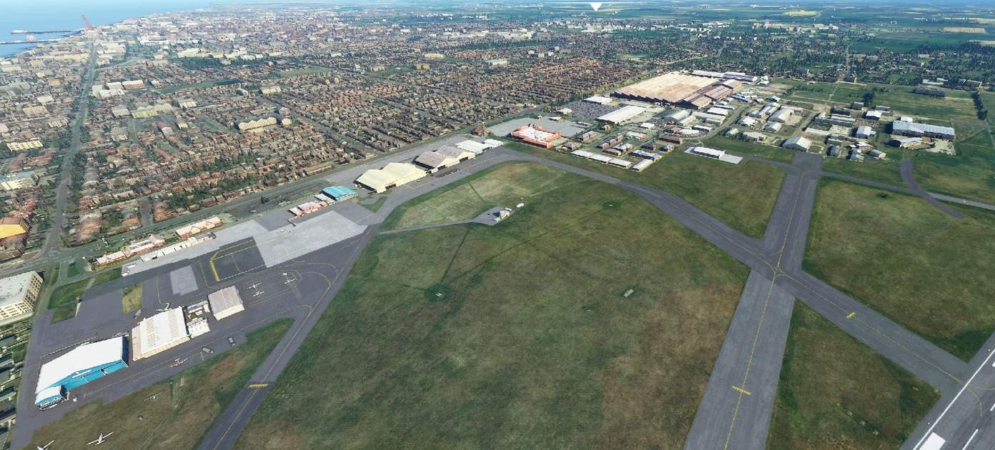
Blackpool Airport, UK v1.0
Photo scenery enhancement of Blackpool AIrport MSFS 2020 Airports 11 Oct, 2021 MSFS 2020 Airports 30 Dec, 2020 MSFS 2020 Airports 14 Sep, 2021
![[8K Livery] Cathay Dragon A320 neo v1.0](https://www.allflightmods.com/wp-content/uploads/2020/10/8K-Livery-Cathay-Dragon-A320-neo-v1.0-2.jpg)
[8K Livery] Cathay Dragon A320 neo v1.0
This livery is based on B-HPB, which will be delivered to Cathay Dragon, And my new racoon eye shape has been applied to this livery MSFS 2020 Liveries 26 Apr, 2022 MSFS 2020 Liveries 8 Nov, 2021 MSFS 2020 Liveries 20 Mar, 2021
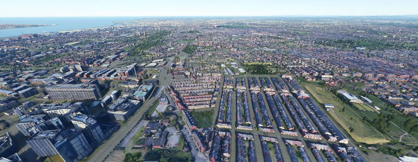
Liverpool City UK v1.0
Liverpool City UK enhancement pack version 1.s MSFS 2020 Scenery 21 Sep, 2021 MSFS 2020 Scenery 8 Feb, 2021 MSFS 2020 Scenery 20 Jun, 2021
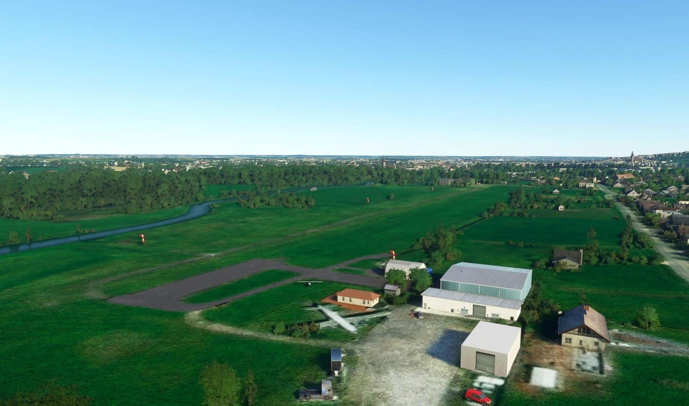
EBGG Overboelare Airfield v0.5
Wikipedia: Overboelare Airfield (Dutch: Vliegveld Overboelare) (ICAO: EBGG) is a private use airport located near Geraardsbergen, East Flanders, Belgium. Features: Corrected runway from concrete to grass as is real-life Corrected coordinates and location of runway to match real-life Replaced auto-gen buildings with standard models provided by MFS 2020 to better match real-life counterparts Replaced textures where applicable to match real-life situation Added some GA parking stands Added generic church buildings for surrounding villages: Deftinge Deux-Acren/Twee-Akren Edingen/Enghien Everbeek Galmaarden Geraardsbergen Goeferdinge Grimminge Herne Idegem Lessen/Lessines Moerbeke Onkerzele Overboelare Parike Schendelbeke Tollembeek Removed unrealistic high buildings from the town of Geraardsbergen/Grammont WIP – Work in Progress Future release: Will update scenery when more free models are being released that match real-life situation (gliders for example) Airport frequencies Night lighting MSFS 2020 Airports 12 Dec, 2020 MSFS 2020 Airports 20 Dec, 2020 MSFS 2020 Airports 1 Oct, 2020
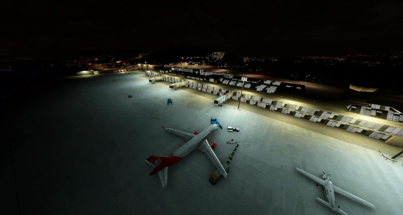
Vigo-LEVX airport lights v1.0
Iluminación del aeropuerto de Vigo-LEVX. El Aeropuerto de Vigo (IATA: VGO, OACI: LEVX) es un aeropuerto español perteneciente a Aena que da servicio a la ciudad de Vigo (Pontevedra). Es conocido popularmente por el antiguo nombre del aeropuerto: Aeropuerto de Vigo-Peinador o simplemente Aeropuerto de Peinador. Se encuentra a 9 km del centro de la ciudad de Vigo, en un terreno del municipio de Vigo.Tiene una pista (01/19) de 2400 m de largo y 45 m de ancho, con un acceso desde la plataforma y una calle de rodaje a la cabecera 01. Tiene un sistema de aproximación por instrumentos ILS CAT II / III en la cabecera 19. La forma antigua Peinador recibe la denominación porque el aeropuerto en ese momento fue construido junto al barrio del mismo nombre, en la parroquia de Torroso, en el municipio de Mos. MSFS 2020 Airports 24 Nov, 2020 MSFS 2020 Airports 26 Oct, 2021 MSFS 2020 Airports 12 Feb, 2022

Boeing 787 Philippine Airlines
"Explore the Boeing 787 Philippine Airlines add-on, featuring an outdated livery with plans for an upcoming refreshed design. Stay tuned for the latest updates!"

EDKN Wipperfuerth Airfield
Enhance your virtual flying experience with the EDKN Wipperfuerth Airfield add-on. Located 20 NM northeast of Cologne, this mod features a grass runway for both motor planes and gliders. Version 1.1 offers improved textures, realistic colors, terraformed apron, parking positions, gas pump, and more adjustments for a more immersive simulation. Download and install to explore this detailed airfield scenery in Microsoft Flight Simulator.
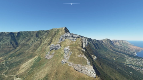
Table Mountain V1.0
Explore a detailed rendition of the rocky formation beneath the cable car on Table Mountain, created by Warren & Emile.
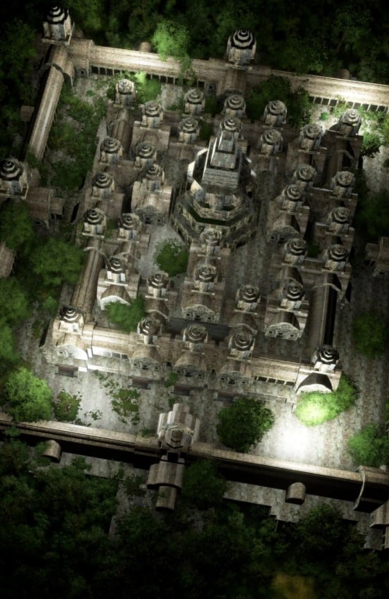
Bayon v1.0
Please insert all packeges because SDK problems I had to do like that polygons-object-light extra, if i do all togheter and give other name MSFS crashes. MSFS 2020 Scenery 8 Mar, 2021 MSFS 2020 Scenery 2 Nov, 2020 MSFS 2020 Scenery 1 Nov, 2020
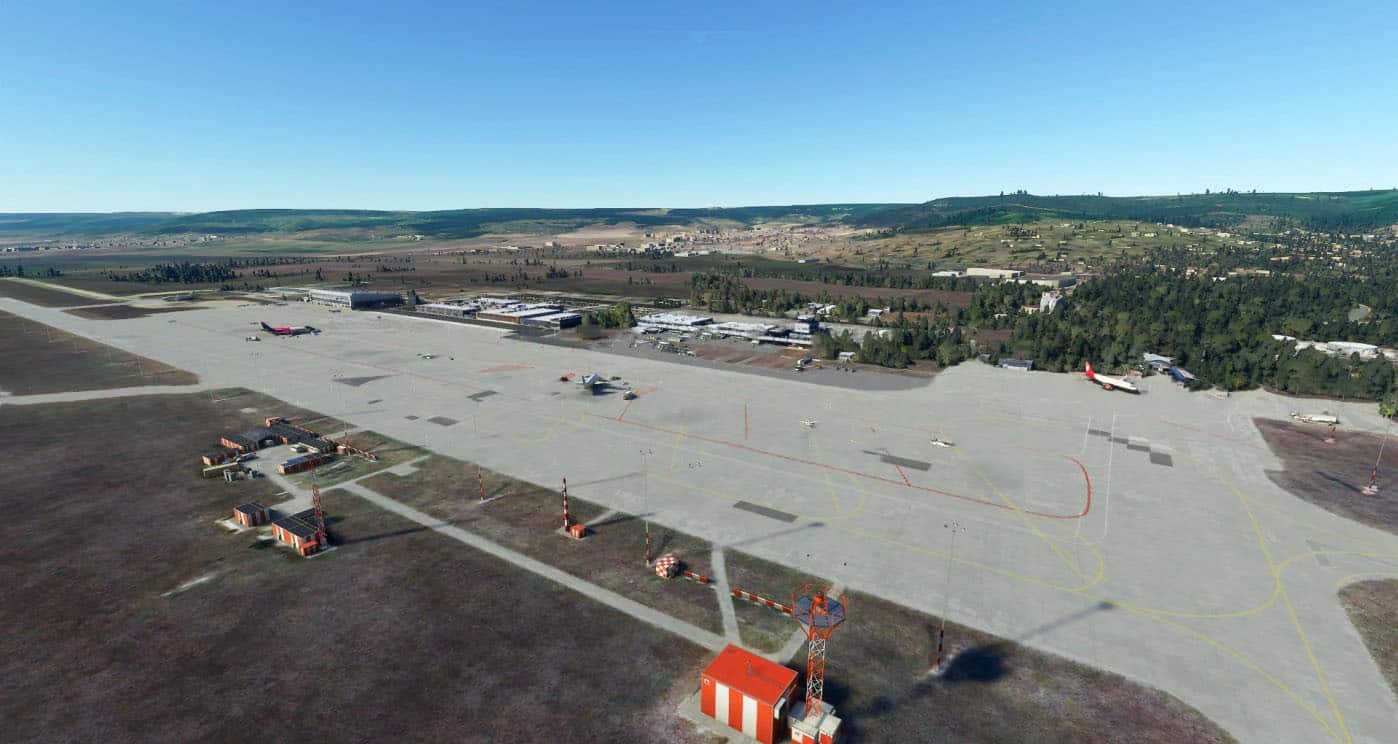
Varna Airport (LBWN) – Bulgaria v1.0
I have pulled Google Maps 3D data using RenderDoc and blender.This mod includes both terminals and the hanger as well as some extra buildings dotted around the airport. All Ramps have been added as well, there are some things that need to be worked around, however it is mostly done. MSFS 2020 Airports 6 Apr, 2022 MSFS 2020 Airports 12 Dec, 2020 MSFS 2020 Airports 22 Feb, 2021
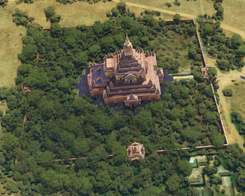
Bagan Sulemani
Explore the intricately detailed Bagan Sulemani add-on, featuring realistic replicas of iconic landmarks like the Sulamani Temple. Created from sketches found on 3D Warehouse, this package offers a unique experience for Microsoft Flight Simulator users.
- 15 per page
- 30 per page
- 45 per page
- 60 per page
-
See more per page
Bigger pages, fewer clicks - and no ads anywhere.
Go Pro